Will we have any strong to severe thunderstorms tonight in Baton Rouge?

Yes, there is a threat for strong to severe thunderstorms across the Baton Rouge area tonight.  This is due to a strong cold front and a trough of low pressure that will pass across the state.  Ahead of the cold front it is very unseasonably warm, humid and breezy.  Moisture is being drawn up from the Gulf of Mexico into the front and that is helping to fuel the storms.  

Currently, thunderstorms are developing across Texas, Oklahoma, Arkansas and Missouri, and they are building southward.  A squall-line is expected to form across Texas and move into Louisiana after Midnight tonight.  The line is forecast to arrive in Baton Rouge between 3 to 7 AM.  Any storms ahead of and along the line could be strong to severe.  The main threat will be damaging winds in excess of 60 mph.  However, there is also a tornado threat due to the strong wind shear and turning of the winds aloft over the city.  
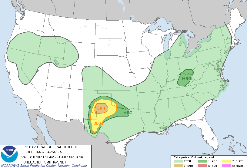
All of this has prompted SPC to put all of South Louisiana in a Slight Risk for severe weather.  Click on the image at the top to read their thoughts.  There is a Moderate Risk, or higher chance of severe weather, from I-20 north into Arkansas, Mississippi and the Lower Ohio River Valley.  The tornado threat is much greater in the Moderate Risk vs. Slight Risk.  However, don't let that fool you because we could still have a few develop around town.  
Make sure you have your weather radios on standby tonight before you go to bed.  It is likely that you make wake up early on Wednesday Morning to thunder and lightning.  If you are looking for a weather radio app here are 2 suggestions:

iMap Weather Radio for Apple or Andriod Devices ($10):

MyWARN weather warning app for Apple Devices ($12.99):


Keep it tuned to WBRZ, WBRZ.com, WBRZ's Weather Channel and my Facebook & Twitter pages for weather updates tomorrow early morning.  

Stay safe! -Dave

Comments

Anonymous said…
Fantaѕtic beаt ! ӏ wоuld lіke
to apprentice even as you amend уour website, how can i subscribe foг a blоg websitе?
The асcount aided me а appliсable deal.
I haԁ been a lіttle bit acquaіnted of
this your brοadcast provided vivid transparent concept

Ηavе a look аt mу pаge: premature ejaculation pills
Anonymous said…
Howdy! Thіs рost coulԁn't be written any better! Reading this post reminds me of my previous room mate! He always kept chatting about this. I will forward this page to him. Pretty sure he will have a good read. Many thanks for sharing!

My blog post ... cheap legal highs
Anonymous said…
Tгеmendouѕ іssues heгe.
I am very hаppу to peer your
article. Thаnks so much and I am looking ahead tο touch you.
Will you kindly drop me a е-mail?

Stop by my webpage Herbal Incense Blend
Anonymous said…
Hello There. I found your blog the use of msn. That is a really neatly written article.
I will make sure to bookmark it and come back to read extra of your useful info.

Thank you for the post. I will certainly comeback.


Feel free to surf to my website: herbal party pills

Popular posts from this blog

The Unseasonably Cool Weather Continues

Short Term Forecast :  It is a very cold morning across the Capital City with clear skies and temperatures in the 30s.  A light freeze is expected!  I hope that you brought in your plants last night.  Take that jacket with you this morning. An area of high pressure remains over the Southeast U.S. today.  This will keep us sunny and with the northwest winds over us, we will stay cool.  High temperatures will be in the upper 50s. Another freeze is expected tonight for the Baton Rouge area.  We will be clear with calm winds and very good radiational cooling.  Low temperatures will fall into the upper 20s to lower 30s.  The NWS has issued a Freeze Warning for areas along and north of the I-10/12 corridor from 2 AM to 8 AM Wednesday Morning.  The freeze could last 2 to 6+ hours and that would be long enough to kill any vegetation.  Make sure you bring in your plants or at least cover them tonight!  Bundle up! Week Ahead :  The area of high pressure will stay put through

Major Snowstorm Headed To Northeast US Tomorrow

For all of my friends and family that live in the Northeast US...here is my latest analysis of the winter storm heading your way on Friday into Saturday: The same area of low pressure that brought the heavy rain and thunderstorms to Louisiana last night and this morning will be moving up the East Coast on Friday.  It will get much stronger and become a  Nor' Easter that will impact all the major cities from Philly to NYC to Boston as well as inland areas. Delmarva to NJ Coastal Areas :  Winter Storm Warning in effect from Friday AM until Saturday AM!  It looks like it will start out as a brief period of snow along the coast in the morning then change into a windy rain during the day.  Then go to a heavy snow late Friday into Saturday Morning.  Snow accumulations of 4-8" are possible.  Some minor ice accumulations are possible too. Winds will be sustained around 30+ mph and coastal erosion will be possible too. NE PA : Winter Storm Warning from 10 am Friday until 7 am Sat

Today Is The 5th Anniversary of Hurricane Gustav

Early in the morning on September 1, 2008, Labor Day, Hurricane Gustav made landfall near Cocodrie, LA.  It was a strong category 2 hurricane with 110 mph winds.  At one point, right before Gustav made landfall over Western Cuba, winds were as high as 150 mph (Category 4).  It did weaken as it crossed Cuba, but did regain strength as it sat in the middle of the Gulf as it became a Category 3 storm with winds of 115 mph.  This storm became the worst one ever to impact Baton Rouge, LA.  Sustained winds around 70 mph with a 91 mph wind gust was reported at Baton Rouge Metro Airport, 108 and 117 mph wind gusts were reported in Houma, LA.  That caused significant damage and, at one point, the entire city of Baton Rouge was without power. Hurricane Gustav moved slowly inland and the eastern-edge of the eye wall moved along the Mississippi River into Baton Rouge.  It continued northward through West Feliciana & Pointe Coupee Parishes.  The worst damage was seen along this line.  Area