
Another cold and rainy day, but changes are coming


Short Term Forecast:  This Wednesday Morning is starting off with mostly cloudy skies and scattered showers across Southeast Louisiana.  It is chilly with temperatures in the mid 30s.  Better bundle up and take that umbrella with you again!

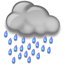
More of the same wet and dreary weather is on tap today.  The stationary front is still in place along the Louisiana and Mississippi Coasts.  This means we will still have plenty of clouds and scattered showers.  The bulk of the rain will come before noon with only spotty showers later in the day.  It will be a cold day with highs only in the lower 40s.

A cold upper-level low will move across Texas and into Louisiana overnight.  This will bring us some freezing temperatures just as the rain ends.  Therefore, I am not expecting any wintry precipitation here in Baton Rouge.  There may be a sleet pellet or two near McComb, MS on Thursday Morning, but that would be it.  We will be partly cloudy overnight as the rain comes to an end.  Lows will be in the lower 30s.

Rest of the Week:  The cold-core upper-level low will move across the Southeast U.S. on Thursday and push the front off to the south and east.  An area of high pressure will build in behind it and that will FINALLY put an end to the rain!!!!!!  Let the dry-out begin!!  We will be sunny, but still cool with highs in the lower 50s.  Thursday Night will be clear with a light freeze as the lows will dip into the lower 30s.

Friday is going to be another gorgeous sunny and dry day!  Highs will be in the upper 50s and lows in the mid 30s.

Weekend Forecast:  The area of high pressure will remain over the Southeast U.S. all weekend.  Therefore we will have sunny skies and some warmer temperatures on Saturday and Sunday.  Highs will be in the lower 60s and lows will still be chilly as the fall to the mid to upper 30s. 

Stay dry and warm today.  Have a good one! -Dave

Comments

Popular posts from this blog

The Unseasonably Cool Weather Continues

Short Term Forecast :  It is a very cold morning across the Capital City with clear skies and temperatures in the 30s.  A light freeze is expected!  I hope that you brought in your plants last night.  Take that jacket with you this morning. An area of high pressure remains over the Southeast U.S. today.  This will keep us sunny and with the northwest winds over us, we will stay cool.  High temperatures will be in the upper 50s. Another freeze is expected tonight for the Baton Rouge area.  We will be clear with calm winds and very good radiational cooling.  Low temperatures will fall into the upper 20s to lower 30s.  The NWS has issued a Freeze Warning for areas along and north of the I-10/12 corridor from 2 AM to 8 AM Wednesday Morning.  The freeze could last 2 to 6+ hours and that would be long enough to kill any vegetation.  Make sure you bring in your plants or at least cover them tonight!  Bundle up! Week Ahead :  The area of high pressure will stay put through

Major Snowstorm Headed To Northeast US Tomorrow

For all of my friends and family that live in the Northeast US...here is my latest analysis of the winter storm heading your way on Friday into Saturday: The same area of low pressure that brought the heavy rain and thunderstorms to Louisiana last night and this morning will be moving up the East Coast on Friday.  It will get much stronger and become a  Nor' Easter that will impact all the major cities from Philly to NYC to Boston as well as inland areas. Delmarva to NJ Coastal Areas :  Winter Storm Warning in effect from Friday AM until Saturday AM!  It looks like it will start out as a brief period of snow along the coast in the morning then change into a windy rain during the day.  Then go to a heavy snow late Friday into Saturday Morning.  Snow accumulations of 4-8" are possible.  Some minor ice accumulations are possible too. Winds will be sustained around 30+ mph and coastal erosion will be possible too. NE PA : Winter Storm Warning from 10 am Friday until 7 am Sat

Today Is The 5th Anniversary of Hurricane Gustav

Early in the morning on September 1, 2008, Labor Day, Hurricane Gustav made landfall near Cocodrie, LA.  It was a strong category 2 hurricane with 110 mph winds.  At one point, right before Gustav made landfall over Western Cuba, winds were as high as 150 mph (Category 4).  It did weaken as it crossed Cuba, but did regain strength as it sat in the middle of the Gulf as it became a Category 3 storm with winds of 115 mph.  This storm became the worst one ever to impact Baton Rouge, LA.  Sustained winds around 70 mph with a 91 mph wind gust was reported at Baton Rouge Metro Airport, 108 and 117 mph wind gusts were reported in Houma, LA.  That caused significant damage and, at one point, the entire city of Baton Rouge was without power. Hurricane Gustav moved slowly inland and the eastern-edge of the eye wall moved along the Mississippi River into Baton Rouge.  It continued northward through West Feliciana & Pointe Coupee Parishes.  The worst damage was seen along this line.  Area