 Looking at the latest forecast models they show something new...the low is forecast to move a little more to the east of the coast, or more offshore, which will not put as much rain/snow inland. This is FANTASTIC!! However, coastal areas may actually see some snow along with the wind of 25-45 mph and a little coastal surge. Fortunately, the strongest wind field seems to be staying more out at sea verses along the coast. Don't be fooled...it will still be pretty windy along the coast and inland. If you see trees that were weakened by Sandy, and could fall, NOW would be the time to take care of them!
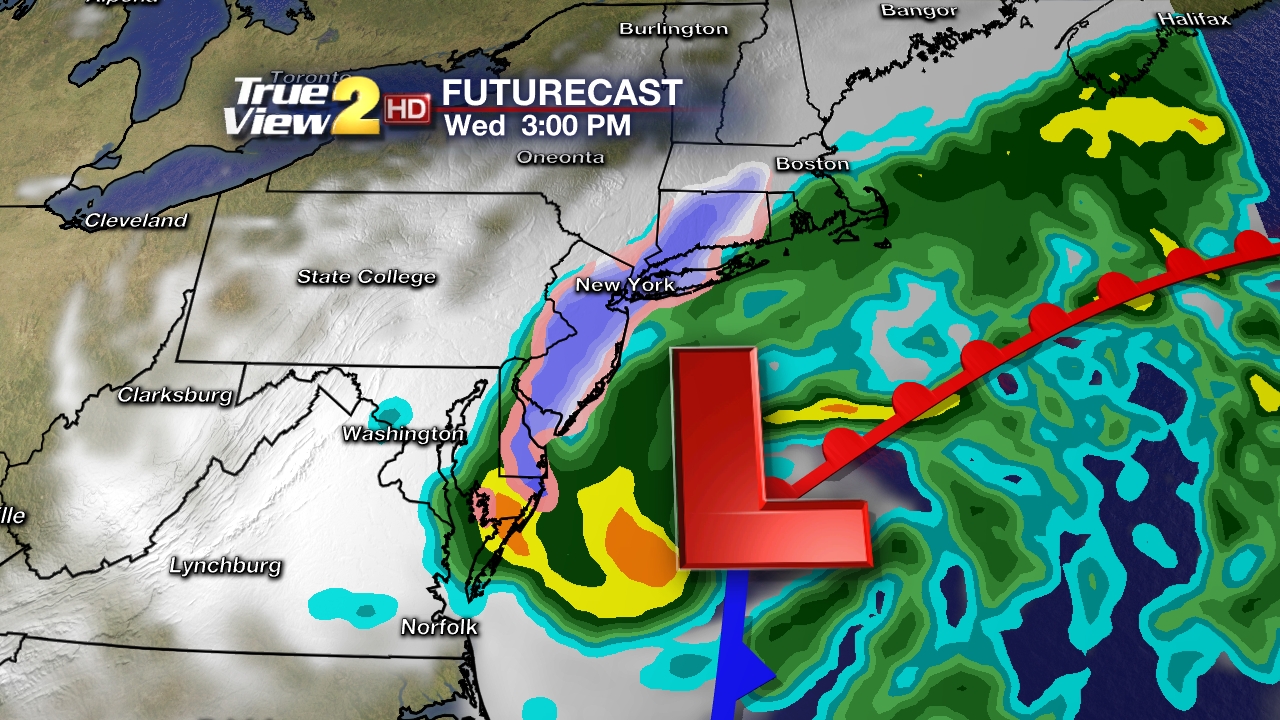
  Coast Forecast...it starts tonight. It will be breezy with scattered showers and chilly temperatures. On Wednesday it will start out as all rain until the late afternoon. Then the rain will mix with snow through the night. Little to no accumulation is expected at this time. Areas more inland in NJ and NY could see some accumulating snow. It will be very windy with speeds around 25-45 mph and higher gusts. A High Wind Watch is in effect. The rain/snow mix will change back to all rain on Thursday and the winds will still be breezy around 25-35 mph. I am also expecting a coastal surge of water which will add high water levels above normal mean high tide. This could cause more flooding in areas where the dunes are gone. A Coastal Flood Watch is in effect from Wednesday AM to Thursday AM.
Inland Forecast for PA, NY, NJ, MD, DE...it will also start tonight with scattered showers and breezy conditions. The rain will mix with snow on Wednesday Afternoon and some minor accumulations are possible as temperatures will be in the 30s. Winds will be pretty strong around 20-30 mph with higher gusts. The event is expected to end on Thursday Night. HOWEVER, if the storm would track closer to the coast, more rain and snow will be possible along with stronger winds.
For Family in St. Marys, PA...looks like you will miss most of the storm. Right now, you will have partly cloudy skies on Wednesday and Thursday with highs in the 40s and lows in the 20s. The forecast models now show you missing out in the rain and snow!
For Family in NE PA...it will start on Wednesday with a mix of rain and snow, then change to all rain on Wednesday Afternoon as the temps. will be in the 40s. It will be a little breezy with winds around 15-25 mph. Wednesday Night will see a transition from rain to ALL snow. Accumulations will not be as bad since the storm is forecast to take a more easterly track. You could see around 1-2 inches in the higher elevations of the Poconos. The snow will come to an end by Thursday Night and the sun will be out on Friday.
Remember is it ALWAYS good to be prepared. Try to get enough gas for your car and generator before the storm...if you can.
I'll continue to post updates here and on my Facebook. Stay safe and aware! -Dave
Comments