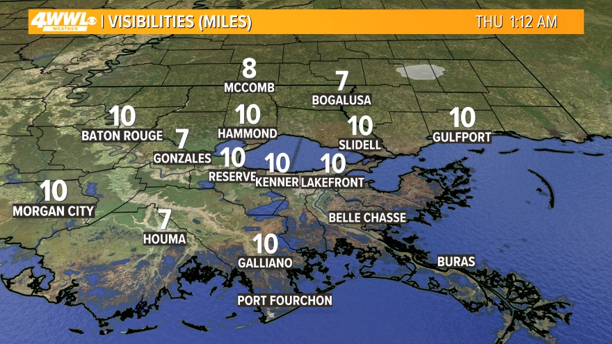
 Watch out for some dense fog this morning across Southeast Louisiana - especially over Lake Pontchartrain. Visibilities could be less than 1/4 over the mid-point of the lake. Fog restrictions are in place on the Causeway. Drive safe! This will likely be an issue for the next few mornings, so plan accordingly.
  We will be even warmer today as high pressure sits off the East Coast and onshore flow continues. This is also adding to the humidity levels, and we will see some marine fog from time to time today. Otherwise, it will be mostly cloudy with a slight chance for a shower. Highs will be in the mid 70s. Tonight will be mostly cloudy with some dense fog at times. Lows will be in the lower 60s.
Thursday and Friday will be even warmer with the ridge of high pressure over the Eastern U.S. and a trough over the Western U.S. We will continue to be more humid with mostly cloudy skies and a few showers. More fog is expected to develop over areas of water, and it could linger throughout the day with reduced visibilities. Highs will be in the upper 70s and lows in the lower 60s.

More of the same weather is expected through the weekend. Each day will have some fog, a mix of sun and clouds and a slight chance for a shower. It will stay very mild with highs in the mid 70s and lows in the upper 50s to lower 60s.
It looks like the chance for rain will go up next week as a cold front moves through. However, I do not see a big drop in temperatures.
Comments