MARINE DENSE FOG ADVISORY until 9 AM for Lakes & Gulf waters
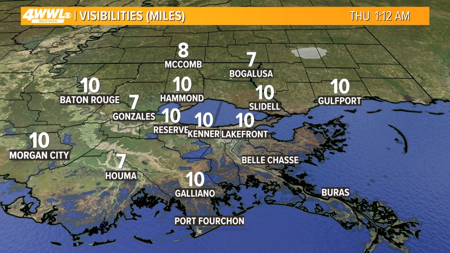 We will have some dense fog across Lake Pontchartrain and other area lakes this morning. Drive safely across the Causeway, Twin Spans and Spillway. Visibility could be less than 1/4 mile at times. Restrictions are in place for the Causeway this morning, so plan accordingly.
  We will have more of the same weather today across Southeast Louisiana. That means more fog with mostly cloudy skies and a slight chance for rain. Expect near record highs in the upper 70s. The record is 79 set back in 1974. Tonight will have more dense fog possible with mostly cloudy skies and a slight chance for a shower. Lows will be in the lower 60s.
Wednesday will continue to be unseasonably mild and humid ahead of a cold front. We will start out the day with some dense fog. Then it will be mostly cloudy with a slight chance for a shower. Highs will be in the upper 70s - near records!
The next cold front will actually move across the region on Thursday. We will be very mild and humid ahead of it, and the atmosphere will be unstable. Expect scattered showers and thunderstorms starting early on Thursday and lasting through Thursday Night. Some of the storms could be strong to possibly severe with damaging winds. Heavy rain is also likely. We could pick up 1-2"+ on Thursday, so watch out for minor flooding issues. Highs will be in the mid 70s. Lows will be in the 50s north and 60s south Thursday Night as the rain slowly comes to an end.
Friday will be a dry day with plenty of sunshine, but it will not cool down behind the cold front. We will stay unseasonably mild with highs in the mid 70s.
 Our next cold front will arrive on Saturday/Sunday. This front will be much stronger and there is a better chance for strong to severe storms along with heavy rain. We will have to keep an eye on this system as it develops off the West Coast of the U.S. the next few days. Plan for some rough weather all weekend with highs in the 70s on Saturday, but 60s on Sunday.
Then it looks like we will return to more normal temperatures for this time of year on Monday. It will be sunny and breezy with highs in the lower 60s and lows will be in the 40s.
Comments