Scattered to numerous showers and thunderstorms are moving into the New Orleans area this afternoon and will continue through the evening. Some heavy rain is possible, but major flooding is not likely. You can expect typical street flooding. Some of the storms could be strong to severe. SPC has put all of South Louisiana in a Marginal Risk for severe weather. The main threat would be damaging winds. Highs will be in the mid 70s.
The rain will taper off after Midnight, and we will be cloudy with just a few showers. Patchy fog will be possible. Lows will be in the lower to mid 60s.
 More showers and storms will follow on Tuesday and Wednesday. A few storms could be strong to severe with damaging winds and a few tornadoes each day. However, the best chance for severe weather will be on Wednesday. The forecast models are not in total agreement as to whether the severe weather threat will be over us, or farther to the north of Louisiana. SPC has us in a Marginal Risk on Tuesday and Wednesday, but parts of SE LA are in a Slight Risk on Wednesday (See image to the left). Needless to say, I will keep an eye on it.
 The forecast models are also showing heavy rain each day, and rain totals between Monday and Wednesday could be around 2-5 inches. Again, major flooding is not likely since we have been dry lately, and the rivers/streams are low. However, typical street flooding will be possible in areas that usually see high water. Remember, DO NOT drive through flooded roadways! Highs will be in the mid 70s each day and lows will be in the mid 60s.
 For Christmas Eve and Christmas Day: Rain chances will decrease some compared to earlier in the week scattered showers possible Thursday, but only isolated showers are now in the forecast for Christmas Day, Friday. The forecast models are now coming in better agreement and show the decreased chance for rain. However, keep the umbrella handy as it will not be totally dry. It will stay unseasonably mild with high temperatures in the 70s both days, and low temperatures in the 60s.
The early outlook for the weekend calls for a decreased chance for rain around 20-30% each day and highs in the 70s, lows in the 60s.
Make sure you keep it tuned to WWL-TV each day, and follow my Facebook and Twitter feeds for updates! -Dave
The rain will taper off after Midnight, and we will be cloudy with just a few showers. Patchy fog will be possible. Lows will be in the lower to mid 60s.
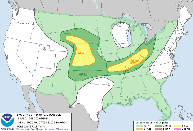 More showers and storms will follow on Tuesday and Wednesday. A few storms could be strong to severe with damaging winds and a few tornadoes each day. However, the best chance for severe weather will be on Wednesday. The forecast models are not in total agreement as to whether the severe weather threat will be over us, or farther to the north of Louisiana. SPC has us in a Marginal Risk on Tuesday and Wednesday, but parts of SE LA are in a Slight Risk on Wednesday (See image to the left). Needless to say, I will keep an eye on it.
 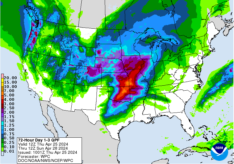 The forecast models are also showing heavy rain each day, and rain totals between Monday and Wednesday could be around 2-5 inches. Again, major flooding is not likely since we have been dry lately, and the rivers/streams are low. However, typical street flooding will be possible in areas that usually see high water. Remember, DO NOT drive through flooded roadways! Highs will be in the mid 70s each day and lows will be in the mid 60s.
 For Christmas Eve and Christmas Day: Rain chances will decrease some compared to earlier in the week scattered showers possible Thursday, but only isolated showers are now in the forecast for Christmas Day, Friday. The forecast models are now coming in better agreement and show the decreased chance for rain. However, keep the umbrella handy as it will not be totally dry. It will stay unseasonably mild with high temperatures in the 70s both days, and low temperatures in the 60s.
 The early outlook for the weekend calls for a decreased chance for rain around 20-30% each day and highs in the 70s, lows in the 60s.
Make sure you keep it tuned to WWL-TV each day, and follow my Facebook and Twitter feeds for updates! -Dave
Comments