
More heavy rain with some severe weather today


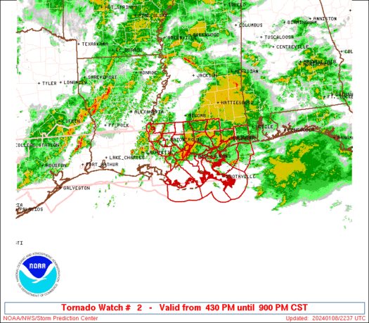
...Tornado Watch Until Noon Today...
...Flash Flood Watch Through This Afternoon...


Short Term Forecast:  This morning is starting out with just mostly cloudy skies and a few showers.  However, that will change later in the morning as a line of heavy rain and thunderstorms moves into Baton Rouge.  Temperatures are in the upper 60s.

The line of heavy rain and thunderstorms will slowly move through Baton Rouge through the afternoon and into the evening hours.  Some of the storms could be strong to severe with damaging winds and a few tornadoes.  SPC has issued a Tornado Watch for much of the Baton Rouge area until 2 PM today.  We could pick up an additional 2-4 inches or more of rain today.  The NWS is continuing the Flash Flood Watch through this afternoon.  Flash flooding is likely so watch for quickly rising water on streams, creeks, roads and area rivers!

This is all due to a slow moving cold front and an area of low pressure.  Since it will be warm and humid ahead of the front along with strong winds aloft we will have the threat for severe weather today. High temperatures will be in the lower 70s.

The rains will slowly taper off tonight and we will be left with mostly cloudy skies.  Lows will be in the upper 50s.

Friday will be a much calmer day with mostly cloudy skies and spotty showers.  It will stay warm and humid thanks to the cold front dissipating over us.  Highs will be in the lower 70s.  Friday Night will be cloudy with patchy fog.  Lows will be in the lower 60s.

Weekend Outlook:  Thanks to the dissipating front lingering over the area, we will have plenty of clouds with a few showers over Baton Rouge on Saturday.  It will be very warm and humid with highs in the upper 70s.  Saturday Night will be mostly cloudy with a few showers and fog.  Lows will be in the lower 60s.

Another cold front will inch its way closer to Louisiana on Sunday.  This will sort of re-energize the old front that is lingering over the Northern Gulf Coast.  We will see scattered showers and storms popping up during the day.  Highs will be in the lower 70s and lows in the mid 50s.

Please stay tuned to WBRZ, the WBRZ Weather Channel, Facebook and Twitter for updates on the flooding and severe weather threats today!  Stay safe and aware! -Dave

Comments

Popular posts from this blog

The Unseasonably Cool Weather Continues

Short Term Forecast :  It is a very cold morning across the Capital City with clear skies and temperatures in the 30s.  A light freeze is expected!  I hope that you brought in your plants last night.  Take that jacket with you this morning. An area of high pressure remains over the Southeast U.S. today.  This will keep us sunny and with the northwest winds over us, we will stay cool.  High temperatures will be in the upper 50s. Another freeze is expected tonight for the Baton Rouge area.  We will be clear with calm winds and very good radiational cooling.  Low temperatures will fall into the upper 20s to lower 30s.  The NWS has issued a Freeze Warning for areas along and north of the I-10/12 corridor from 2 AM to 8 AM Wednesday Morning.  The freeze could last 2 to 6+ hours and that would be long enough to kill any vegetation.  Make sure you bring in your plants or at least cover them tonight!  Bundle ...

Flash Flood Watch now until Thursday Evening for WBRZ Viewing Area

The NWS in Slidell, LA has issued a  Flash Flood Watch for all of the WBRZ Viewing Area starting now and continuing until Thursday Evening. Rain has been falling for the last few hours and we have already picked up over 1.30" in Baton Rouge.  This is WAY more than the forecast models were predicting for this time.  The area of low pressure continues to develop over South Texas and a warm front will move up from the Gulf of Mexico by Wednesday Morning.  This will spread widespread rain and a few thunderstorms over Southern Louisiana all night and into Wednesday.  Then it looks like we will taper off the rain to just scattered showers during the day on Wednesday. On Wednesday Night, a cold front will move out of Texas into Louisiana.  As this happens, a squall line of thunderstorms is expected to move ahead of it and through Baton Rouge on Thursday Morning.  Some of these storms could be strong to severe with damaging winds and a few tornadoes. ...

Major Snowstorm Headed To Northeast US Tomorrow

For all of my friends and family that live in the Northeast US...here is my latest analysis of the winter storm heading your way on Friday into Saturday: The same area of low pressure that brought the heavy rain and thunderstorms to Louisiana last night and this morning will be moving up the East Coast on Friday.  It will get much stronger and become a  Nor' Easter that will impact all the major cities from Philly to NYC to Boston as well as inland areas. Delmarva to NJ Coastal Areas :  Winter Storm Warning in effect from Friday AM until Saturday AM!  It looks like it will start out as a brief period of snow along the coast in the morning then change into a windy rain during the day.  Then go to a heavy snow late Friday into Saturday Morning.  Snow accumulations of 4-8" are possible.  Some minor ice accumulations are possible too. Winds will be sustained around 30+ mph and coastal erosion will be possible too. NE PA : Winter Storm Warning from 10...